Twelve places stand out when you go looking for off the beaten path Australia experiences that still feel genuinely wild: Moreton Island, Millaa Millaa Falls, Babinda Boulders, Finch Hatton Gorge, the Paperbark Forest Walk, Carlo Sand Blow, Karijini National Park, the Kimberley, and Bruny Island top the list, alongside quieter corners of the Northern Territory, South Australia, and Tasmania. Most sit within a few hours of a regional hub, though a handful demand real planning. Highway 1) links the coastal capitals but rarely goes near the good stuff, so expect detours. Tourism Research Australia tracks where domestic travellers are actually spending nights, and it’s not always where you’d guess.
The one rule that matters before you book anything: match your vehicle and your season to the place, not the other way around.
- Moreton Island, QLD — 4WD only, ferry from Brisbane, best April to October
- Millaa Millaa Falls, QLD — sealed road, self drive, year round but lushest after summer rain
- Karijini National Park, WA — flight to Paraburdoo plus 4WD, May to September for cooler gorge walks
- The Kimberley, WA — 4WD essential, dry season only (May to October)
- Bruny Island, TAS — car ferry from Kettering, best November to April
- Carlo Sand Blow, QLD — short walk from Rainbow Beach, any season, sunrise or sunset
Pro Tip: Book accommodation near these spots at least six weeks out during school holidays. Regional towns near hidden gems have a fraction of the beds you’ll find in tourist hubs, and they fill fast.
Key Takeaways
Reaching Australia’s genuine hidden gems comes down to matching the right vehicle and season to each site, and calling in a local guide wherever permits, tides, or track conditions make self driving risky.
| Point | Details |
|---|---|
| Shortlist spreads nationwide | Moreton Island, Karijini, the Kimberley, and Bruny Island anchor a route across four states plus Tasmania. |
| Season dictates access | Dry season (May to October) is essential for the Kimberley, Karijini, and Arnhem Land; wet season floods roads shut. |
| Permits aren’t optional | Arnhem Land and some pastoral crossings require permits arranged weeks ahead, not on arrival. |
| Wittenoom is off limits | The former mining town remains asbestos contaminated and authorities warn against any visit. |
| Local guides unlock the hardest country | Aussie Loop connects travellers with local operators for the Kimberley, Daintree, and Tasmania’s wilder coastlines. |
Table of Contents
- Western Australia: the Kimberley, Karijini, and coastlines nobody talks about
- Northern Territory: what’s worth chasing beyond Kakadu
- South Australia: lunar landscapes and coastlines nobody photographs
- East coast hidden gems from Queensland to Victoria
- Tasmania’s wild edges: Bruny Island and beyond
- How to plan a trip to Australia’s remote corners without getting caught out
- Suggested itineraries that string these gems together
- Respecting the places and people you’re visiting
- Sources
- FAQ
Western Australia: the Kimberley, Karijini, and coastlines nobody talks about
The Kimberley rewards anyone willing to leave the highway. Detour off the Gibb River Road to reach Bell Gorge or Manning Gorge, both swimming holes worth the corrugated dirt. Go May to October only. The wet season floods river crossings and cuts the region off entirely, and a high clearance 4WD is non negotiable here, not a suggestion.
Karijini National Park delivers gorge walks through 2.5 billion year old rock, with Hancock Gorge and Hamersley Gorge among the standouts. Fly into Paraburdoo or Newman, then 4WD in. Some gorge sections close seasonally after flood damage, so check current park alerts before you commit.
For coastline without crowds, look at Cape Range near Exmouth rather than the obvious Ningaloo access points.
One warning that overrides everything else in this section: do not visit Wittenoom. The old asbestos mining town remains a contaminated site with serious, ongoing health risks, and authorities can fine unauthorised visitors. It shows up on “abandoned towns” lists constantly. Skip it.
Pro Tip: Carry at least 10 litres of water per person per day in remote WA, plus a spare fuel container. Servos can be 300 kilometres apart out here.
Northern Territory: what’s worth chasing beyond Kakadu
Arnhem Land holds some of the country’s most significant rock art and least visited landscapes, but you need a permit from the relevant land council before entering, and travelling with a local Aboriginal guide is the respectful, and often only legal, way in.
- Arnhem Land — permit required, fly or 4WD from Jabiru, dry season access only
- Litchfield’s quieter waterholes (Wangi Falls gets the crowds; Buley Rockhole and Florence Falls see far fewer)
- Gregory National Park — remote, sealed access to the edges, 4WD for the interior tracks
- Nitmiluk Gorge’s upper pools — canoe or tour boat beyond the first gorge to escape the day trippers
The Top End doesn’t forgive complacency. Seasonal flooding can close roads for weeks, saltwater crocodiles inhabit far more waterways than tourists expect, and mobile coverage disappears fast once you’re off the Stuart Highway.
Base yourself in Darwin, Katherine, or Jabiru, and book an organised tour if you’re short on 4WD experience or local knowledge.
South Australia: lunar landscapes and coastlines nobody photographs
The Flinders Ranges reward anyone who turns off at Blinman and heads toward Parachilna Gorge or Alkaranji, red gorge country with almost no other cars. A high clearance vehicle helps but isn’t always mandatory. Go April to October and skip the summer heat entirely.
- Remote Eyre Peninsula coves near Coffin Bay, quiet white sand beaches without the crowds of the main township
- Simpson Desert fringe tracks — genuine 4WD territory, permits required for some pastoral station crossings
- Flinders Ranges backroads around Wilpena Pound, best avoided after rain when clay tracks turn to mud
Accommodation thins out fast past Port Augusta, so book station stays or small town pubs ahead, and always ask before crossing pastoral leases. Much of this land is working farmland, not public reserve.
East coast hidden gems from Queensland to Victoria
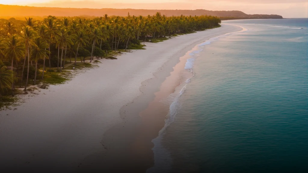
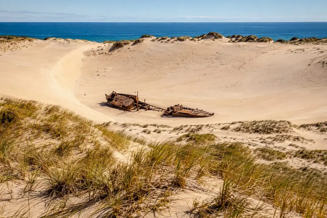
Moreton Island sits a short ferry ride from Brisbane yet feels like a different country: sand dunes, shipwrecks, and the Tangalooma wrecks snorkel site. Access is 4WD only once you’re off the ferry, and April to October avoids the humidity.
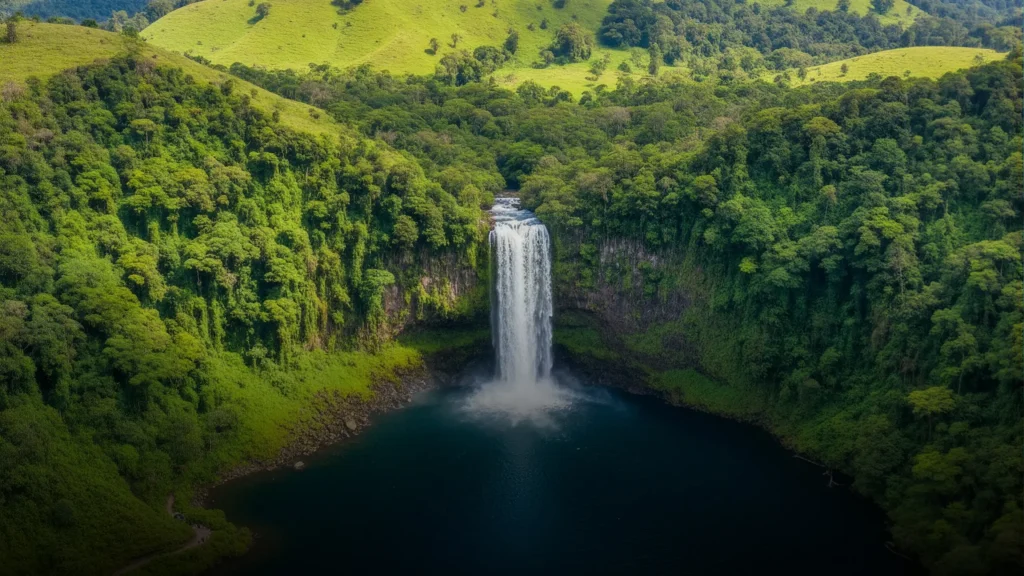
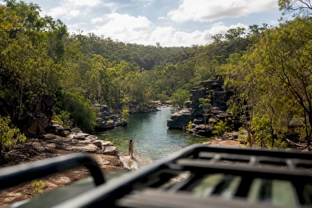
Millaa Millaa Falls, on the Atherton Tablelands, is a sealed road day trip from Cairns and part of the classic “waterfall circuit” alongside Zillie and Ellinjaa Falls. Babinda Boulders, further south near Innisfail, has a stunning swimming hole, though the upper boulder section carries genuine drowning risk after rain and is closed to swimming for good reason.
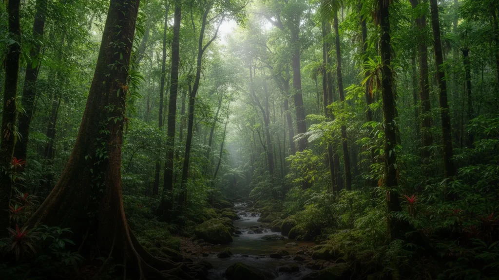
Finch Hatton Gorge, inland from Mackay, requires a short 4WD creek crossing to reach Araluen Falls, best tackled in the dry months. The Paperbark Forest Walk near Cape Tribulation is an easy boardwalk loop through mangrove and paperbark swamp, ideal for families wanting Daintree without a full day commitment. A local guide through Daintree Dreaming adds cultural depth most self drive visitors miss entirely.

Carlo Sand Blow, near Rainbow Beach, is a short walk to a massive shifting sand dune with ocean views, no permit or vehicle needed.
Pro Tip: Camp near Finch Hatton or Cape Tribulation instead of the nearest big town. You’ll get a genuinely dark sky and cut your drive time to the trailhead in half.
Tasmania’s wild edges: Bruny Island and beyond
Bruny Island delivers oysters, cheese, and coastal walks with a fraction of the mainland’s crowds. Catch the car ferry from Kettering (about 40 minutes south of Hobart) and allow a full day, longer if you want South Bruny’s lighthouse walks. A three hour wilderness cruise is the easiest way to see the sea cliffs without driving yourself.
- Bay of Fires side tracks north of Binalong Bay, where lichen turns the granite boulders vivid orange
- South Coast Track — multi day wilderness walking, only for experienced hikers with proper gear
- Bruny Island’s southern lighthouse walk — half day, moderate fitness required
November to April brings the calmest weather. A guided Bay of Fires experience is worth booking if you want the region properly explained rather than just photographed.
How to plan a trip to Australia’s remote corners without getting caught out
Treat any trip into genuinely remote country as a small expedition, not a scenic drive.
- Choose the right vehicle. Sealed roads suit a standard car; anything past a national park boundary in WA, the NT, or outback SA usually needs a 4WD.
- Plan fuel and water with margin. Carry extra of both. Distances between servos in remote regions routinely exceed 200 kilometres.
- Sort comms before you leave. A satellite phone or PLB matters once mobile coverage drops out, which happens fast off the highway.
- Buy travel insurance that covers remote activity, and register your route with someone who’ll notice if you go quiet.
- Check permits early. Arnhem Land and some pastoral crossings need weeks of lead time, not a phone call the day before.
Some places are under visited for good reason and others are dangerous, contaminated, or culturally restricted. Government and tourism authorities are the only reliable word on which is which. Do not visit Wittenoom, regardless of what an old blog post suggests.
Pro Tip: Book a local guide for the Kimberley or Arnhem Land rather than self driving your first time through. You’ll see more, understand the country better, and skip the mistakes that turn a highlight into a rescue callout.
Suggested itineraries that string these gems together
A ten day Queensland loop works well starting in Cairns: Paperbark Forest Walk and Daintree on day one and two, Millaa Millaa Falls and the Atherton Tablelands waterfall circuit on day three, then south to Finch Hatton Gorge near Mackay for two nights, finishing with Babinda Boulders on the way back north. That’s roughly 900 kilometres of driving, entirely on sealed roads, with two short 4WD detours.
For Western Australia, allow ten to fourteen days minimum: fly into Broome, spend four days working the Gibb River Road toward Kununurra, then either fly out or continue south toward Karijini for another four days of gorge walking. This is dry season only territory, and the driving days are long.
A Tasmanian week suits Bruny Island, Bay of Fires, and one wilderness walk comfortably, based out of Hobart with two nights near Binalong Bay. If you’re building a longer trip that strings multiple regions together into a proper lap of the country, three months is the realistic minimum for a pace that doesn’t feel rushed, and six to twelve months gives you room for every worthwhile detour along the way. Regional Australia captured a large portion of domestic overnight spend recently, proof that plenty of travellers are already choosing these quieter routes over the coastal highway grind.
Respecting the places and people you’re visiting
Many of these destinations sit on Aboriginal land, and that history shapes how you should behave once you arrive. Arnhem Land’s rock art sites, Kakadu’s sacred sites, and the Daintree’s Kuku Yalanji country all carry cultural protocols that go beyond a simple “look but don’t touch.”
Ask before photographing people, not just landscapes. Some sites are restricted to particular genders or require a traditional owner present, and a permit or local guide will tell you exactly what’s appropriate. Stick to marked trails around culturally significant sites even when a shortcut looks harmless, because erosion and unauthorised access genuinely damage places that have been cared for over tens of thousands of years.
Buying from Aboriginal owned tour operators and art centres puts money directly back into the communities protecting these landscapes, rather than into a generic tour company with no local connection. A Kuku Yalanji guided walk through the Daintree, for instance, explains bush food and medicine in a way no self guided walk ever could.
Pastoral land etiquette matters just as much in South Australia and the Kimberley. Close gates behind you, stick to formed tracks, and never assume a quiet looking paddock is public land. Locals notice, and word travels fast in small regional towns about visitors who don’t.
Why we favour curated, local‑led trips for fragile or remote places
Remote Australia rewards preparation and punishes assumption in equal measure. A local guide through the Kimberley or Arnhem Land turns a logistically risky trip into a genuinely richer one, which is exactly why Aussie Loop backs local operators over generic itineraries.
Reach these places with a curated, local-led tour
Self driving works for Millaa Millaa Falls or Carlo Sand Blow, but the Kimberley, Arnhem Land, and Tasmania’s wilder coastlines are a different proposition entirely, with permits, tide charts, and seasonal closures that trip up even experienced travellers. Aussie Loop cuts through that homework by connecting you directly with local operators who already hold the permits, know the current track conditions, and can get you to places a rental car simply can’t reach.
Browse the full tours listing for options across Queensland and Tasmania, including the Daintree Dreaming Aboriginal cultural adventure for rainforest country and the Bruny Island wilderness cruise for Tasmania’s southern coast. If you’d rather stay behind the wheel for the flatter, sealed stretches, independent van hire is a solid complement to a guided leg through the harder country. Check tour dates for your travel window and book the trickier regions first. They fill quickest.
Sources
FAQ
What is the dodgiest place in Australia?
Safety indices vary by year, but inland centres including Alice Springs, Rockhampton, and Darwin have appeared among Australia’s higher concern cities in recent rankings. Check current local advisories before you travel through any regional centre.
Is $70,000 a good salary in Australia?
A solid, above-average income in most Australian regional and metro areas comfortably covers a multi week trip incorporating several remote destinations, though affordability varies between cities like Sydney and Melbourne.
Is there a road that goes all the way around Australia?
Not a single continuous highway. Highway 1 is a network of linked state roads covering roughly 14,500 to 14,750 kilometres and connecting most mainland capitals, but road quality and services vary enormously along the route, and reaching inland gems like Karijini or the Kimberley means detouring well off it.
What is the most secret base in Australia?
Australia has several defence and joint facilities with restricted public access, most notably Pine Gap near Alice Springs. These are not tourist destinations and are unrelated to the hidden gems covered here.
Do I need a 4WD for the Kimberley or Karijini?
Yes. Both regions require a high clearance 4WD for unsealed sections, particularly the Gibb River Road and Karijini’s gorge access tracks, and neither is passable in the wet season.